Bascule Bridges, North to South
While New Hampshire has the shortest coastline of any coastal state, it has two great estuaries – the Great Bay and Hampton River. In the 18th century, area rivers and the Great Bay became barriers to travel and trade between the Seacoast and newly settled inland towns. Movable bridges at key crossings facilitated the movement of people and goods along New Hampshire's roads and waterways.
Between 1773 and 1949, eleven bascule bridges were constructed in the state. Seven of the state's bascule bridges were toll bridges at one time, as private companies and state and local governments sought ways to finance the new infrastructures. Changes in patterns of trade, as well as engineering advances in bridge designs and high maintenance costs, have made movable bridges unnecessary or prohibitive in some locations, and are therefore less abundant.
You can read all about the history of these bridges in the NH Department of Transportation's 60 page booklet
Historic Movable Bridges of NH - click
here (opens in a separate browser tab).
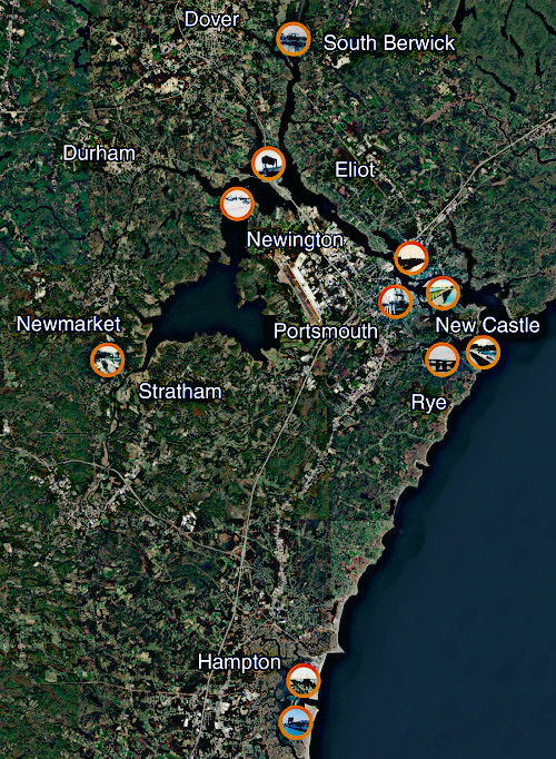
Interactive map - Click an orange-cirled bridge in the map below to read more about it.
Maps on the individual bridge pages are also interactive.